A scratch-built map and campaign world designed in Wonderdraft.
Skills: Working under tight constraints, managing complex projects, learning new software.
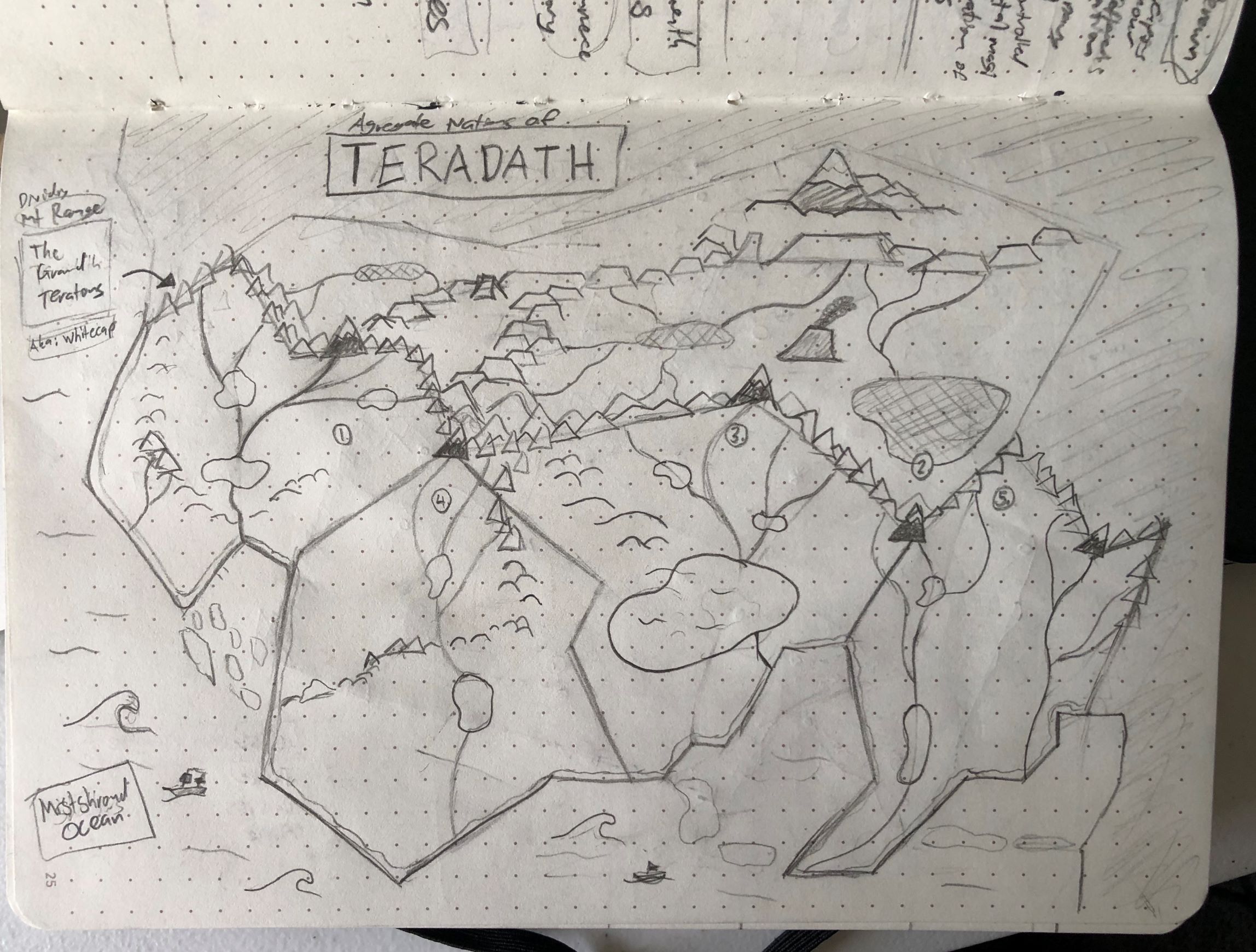
Proof of Concept Sketch
The campaign map of Teradath began as a mockup sketch of the land’s overall shape and the defining features of each region.
While the final result differed wildly from the original concept, the large dividing mountain ranges stayed along with the climate contrast between the northern and southern territories.
Landforms and Elevation
During the sketching process, I did some research to find a digital cartography software that emphasized artistic applications. Wonderdraft seemed to be the best choice due to its simple UI and powerful tools.
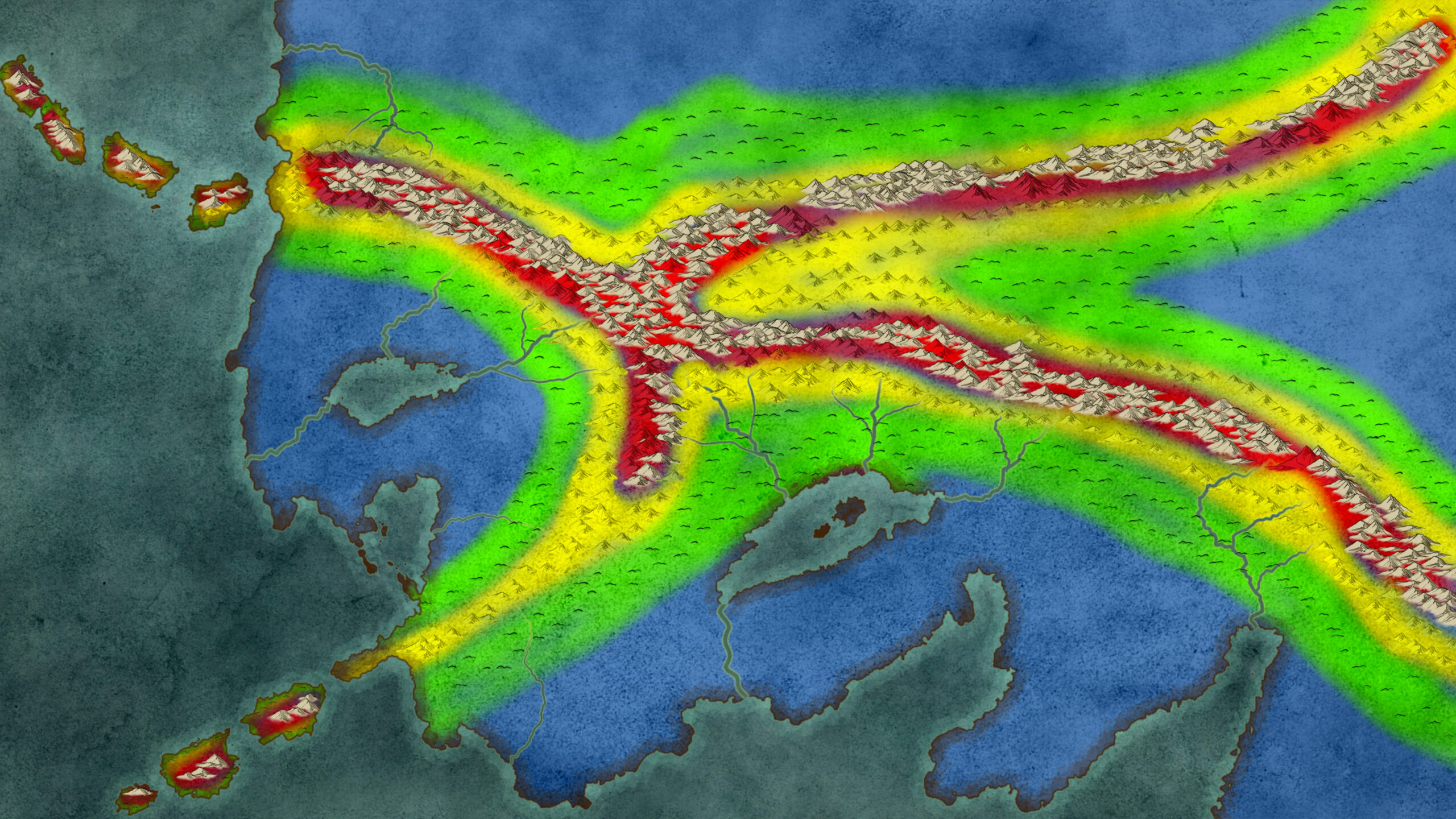
After creating the base outline of the map in Wonderdraft, I created an elevation map to help guide the process of laying down river systems and informing the placement of lakes.
I also added islands and refined the mountain arrangement to better emulate a more realistic interpretation of tectonic motion. Around this point was where I realized how incredibly volatile and earthquake-prone this fictitious location would be. But hey, perfect excuse to add a volcano.
Terrain and Foliage
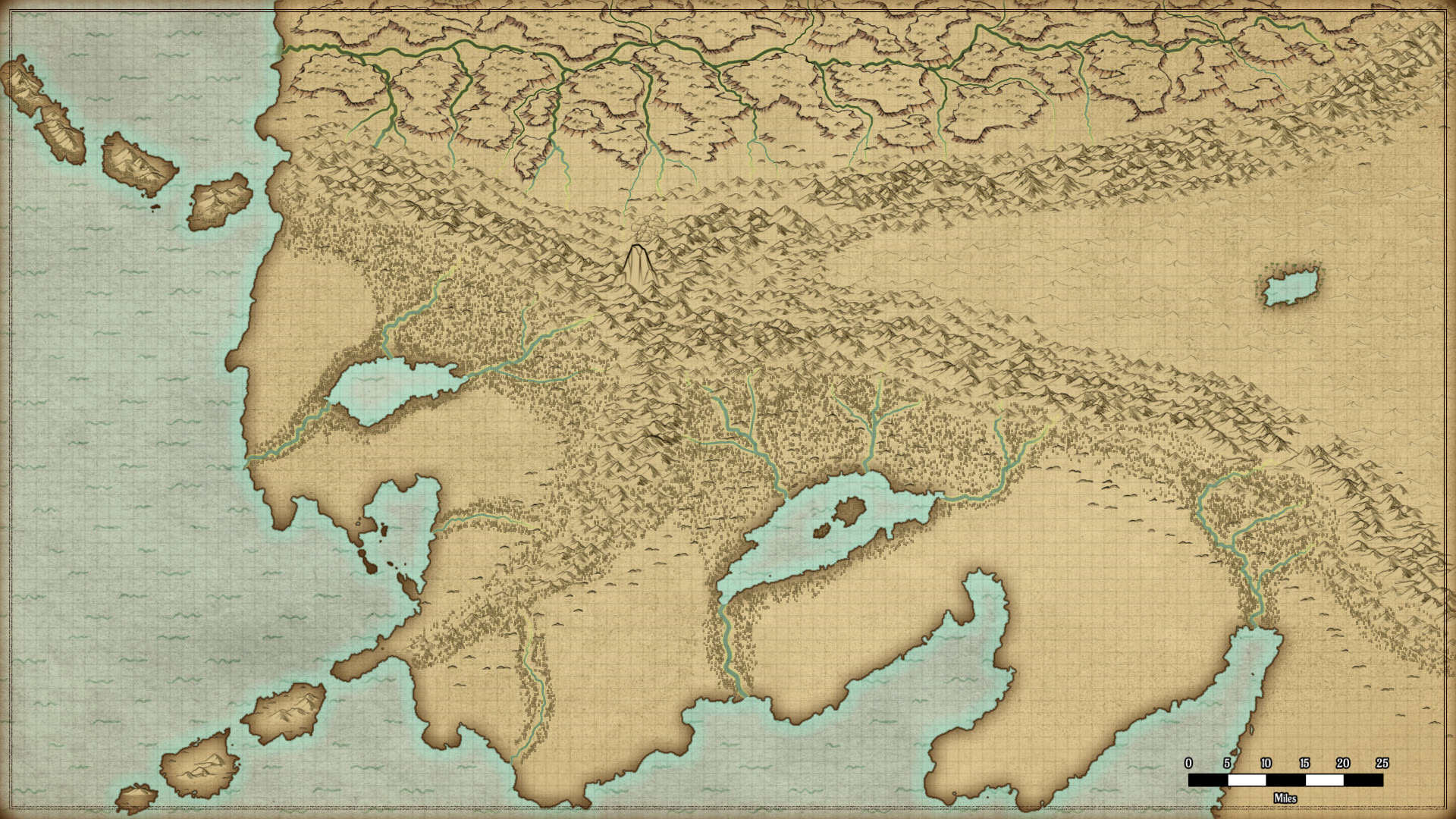
The placement of the rivers, lakes, and mountains helped inform the placement of forests. Rain shadows were considered as well as the proximity of the southern territories to the ocean. As a result, the southern territories received more lakes and foliage.
Due to its fairly centralized placement between two mountain ranges, I decided to transform the northeastern section of the map into a desert. Also, the northernmost territory was transformed into a semi-arid drainage basin/badland due to its comparative location to the mountains.
Resources and Communities
Using all of the maps above as reference, I created a resource map which considered how agriculture, aquaculture, livestock, and mining resources would affect settlement location, regional roles, and population density.
I placed cities, towns, and villages in locations that would allow its citizens to take advantage of these resources. Capitals were strategically placed in locations where trade routes and rivers would be most likely to intersect.
As for the placement and division of country lines, I considered how real-world borders tend to be drawn along natural barriers like mountains, woodlands, oceans, lakes, and rivers.
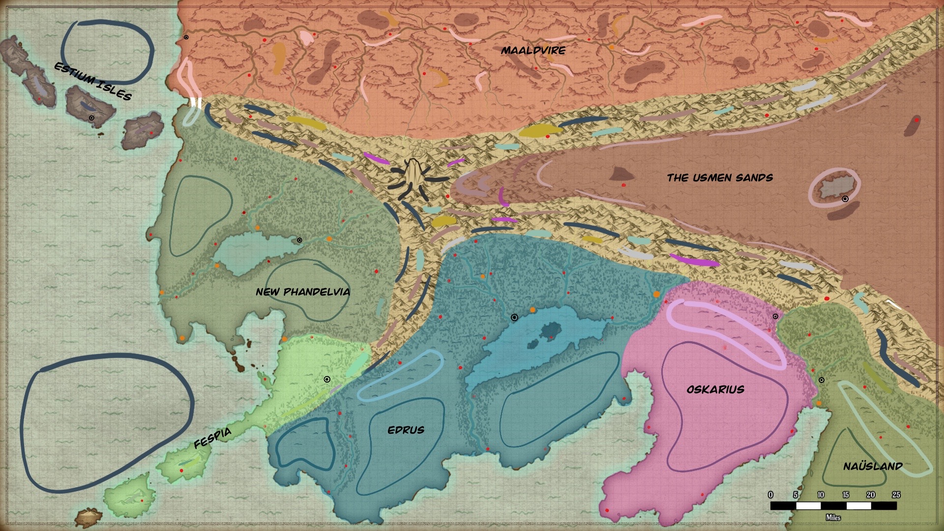
Finishing Touches
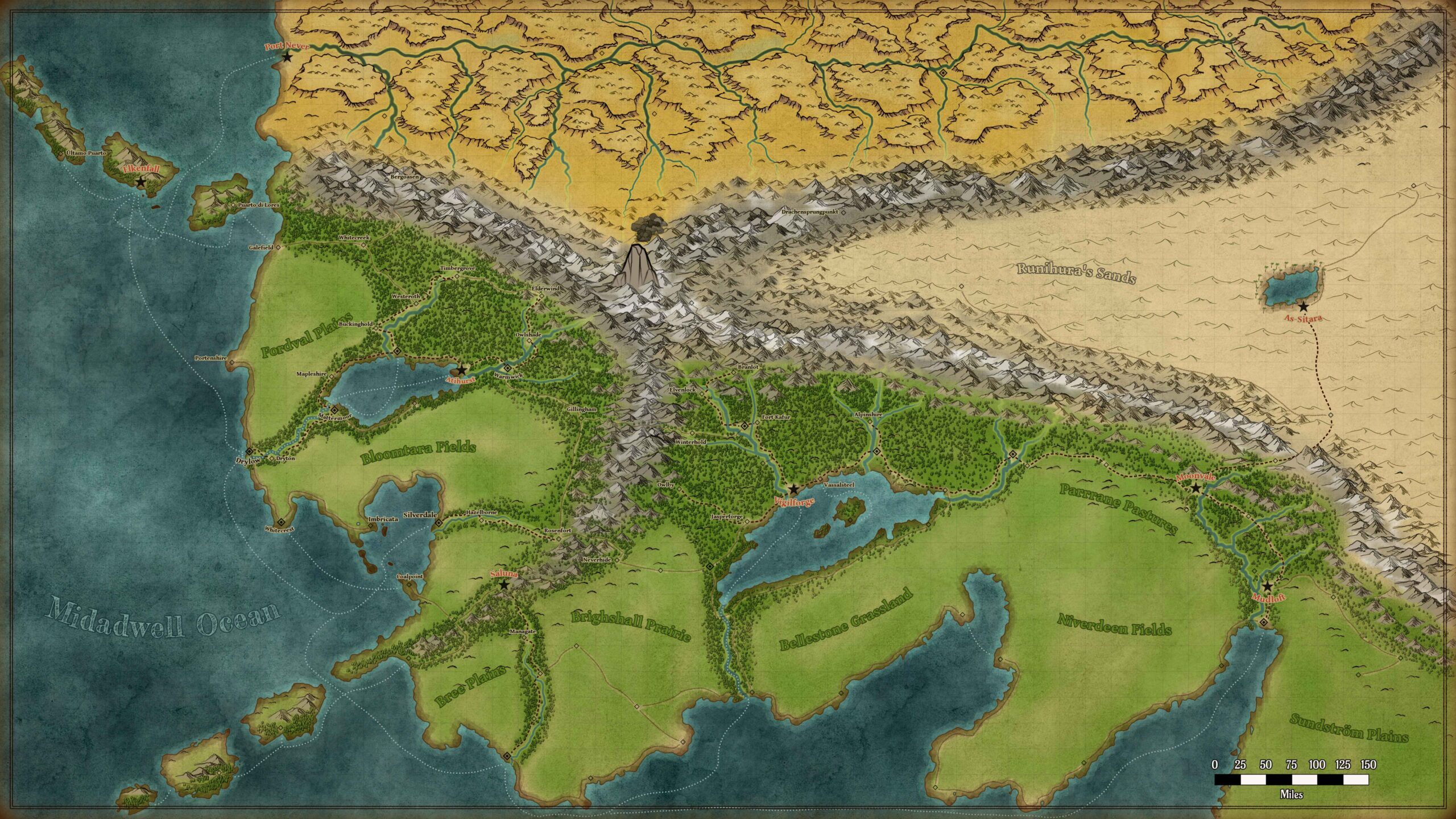
Finally, after all the logistical steps were completed, I was able to give life to the map design by providing color and titles to the different towns, settlements, and major natural landmarks on the map.
Naming schemes were created for different regions to give each country its own sense of history and character.
For instance, I referenced real-life American and British town names for the more new world-inspired region of New Phandelvia. In contrast, the more ancient, traditional Edrus region references more traditional fantasy settlement names in its naming scheme.
